2010 was an eventful year. I suppose any year one decides to pick up and move half way around the world would fall into the "eventful" category. Nevertheless, the end of 2010 came and went without much fuss. I had a quiet Christmas with Leanne and her parents. They cooked excellent food, following a general theme of what I (being form the northern hemishpere) would concider normal at Christmas. Our drinks on the otherhand represented the summer environment in which we found ourselves - Margaritas and Daquaries.
After Christmas, Leanne and I had planned a trip to the west coast to climb at a remote 1,000 ft cliff in the Tyndall Mountains. Images and comments about the place that I had come across suggested a beautiful and exiting adventure. Still, the fact that this part of the Island receives about 5 ft of rain per year should have tipped me off to what type of situation I was about to get into. To access the cliff, you climb up the back side of a mountain and then rappell down the main vertical face. Once at the bottom, you find yourself in complete wilderness, and have to climb the cliff to get out. This seriousness of adventure requires quite a bit of gear, and thus heavy packs (mine was about 80lbs on this occasion). I’ll spare most of the details of our trip although I would like to make the following suggested change to the guidebook’s description for the approach as what we read and what we experiences were a bit juxtaposed:
Follow the dirt road from the car park and ford the stream
Leave the road at the hiking registry and step bravely into the knee-deep mud of the bog.
Flounder across the bog to gain a steep muddy stream at the base of the mountain. Ascend this muddy stream up 2000ft of elevation gain until you are completely surrounded by clouds and the snow is a good 4 inches deep. At this point, leave the stream in a northeasterly direction and wander through the fog and snow until you find yourself about to step off a 1000ft cliff. From here walk either left or right (you’ll likely have no idea where you are, so it’s about 50/50 either way) and if you’re lucky you’ll come across bit of overhanging rock in a small cliff band under which you can spend the night.
We spent the night hoping for the weather to improve. We’d seen this picture of what we might expect to be greeted with upon awakening (http://www.thesarvo.com/), But all we saw was fog.
We spent a good part of the next day waiting for better weather, but in the end we decided to give up. We hiked out without ever seeing the actual cliff, said our fond farewells to the mountain,
and drove home. As a consolation prize, we decided to do Mt Claude by way of the Rysavy Ridge. This climb was more mountaineering than climbing as it was technically quite easy, but the ridge was fairly exposed, especially the last traverse across the summit, and had some nice views of the surrounding countryside. It also had a comparatively easy approach and descent which we found a nice alternative to the previous trip.


We rang in the New Year without fanfare, and currently I don’t have any new adventures planned…yet. Of note however are that 1) I now have an inverter to charge my hammer drill which may lead to some new climbing projects, 2) The lake is down enough to allow for bouldering at probably the best area on the island for such a pastime, and 3) I bought a tripod for my video camera which hopefully will allow me to document some of my future excursions. Until then I’ll leave you with a few photo’s I’ve taken recently that haven’t fit in with any other posts but I feel are worth posting nonetheless:
A Little penguin (formally called a Fairy Penguin) as it came in from a day at sea on the East coast of Tasmania. I took advantage of him while he was pondering his predicament concerning this log across the trail to take this photo. I don’t think my flash helped his concentration
A rainy afternoon photo of the Alum Cliffs above the Mersey River in northern Tasmania
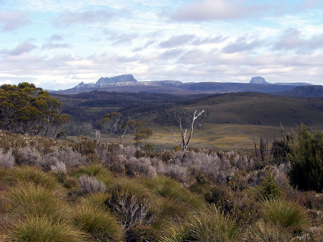
Lastly, a shot of Cradle Mountain in northern Tasmania as we returned from the west coast this past week.


